Buttermere Trip - 14-15th May 2009
I am privileged to be invited to the Grant Thornton (“GT”) activity trip to Buttermere in the Lake District over the two days – 14th and 15th May 2009. Our hosts are entertaining clients in the Bridge Hotel and Sir Chris Bonington, CBE is to address the audience on his climbing experiences before dinner on Thursday 14th and then is to join us on the Via Ferrata up to the top of Honister Crag (2,126ft) on Friday morning.
We have three great guides in Paul, Adam and Chris who will accompany participants on the various hard/easy optional walks on Thursday and Friday. The hard walk on Thursday left the hotel at 10am on a dry but windy morning and we were all immediately into a steep climb up to High Snockrigg (526m) and then on to Robinson (737m). In the col at Littledale Edge (in a sheltered hollow) we enjoyed a brief lunch stop and then it was up to Hindscarth (727m). We traversed along the ridge to Dale Head (753m) and enjoyed the great views all around. It was then down to Honister Slate Mine where Rob kindly arranged teas at the cafe. Here there were options for all, get the bus back, do a lower walk by Warnscale Bottom and Buttermere Lake or ascend Hay Stacks (597m) on the way back to the hotel. This later route was a total of 20kms. All had to be back for 6pm at the latest and this was achieved as the presentation by Sir Chris Bonington CBE was to commence at 6.30pm. This was a wonderful occasion to have such an icon of world mountaineering and expeditions in our midst and sharing with us his experiences on Mt Everest and many of the other great climbs and expeditions he lead. Conversation flowed over a magic dinner and afterwards in the lounge where all continued to enjoy themselves and reminisce on a wonderful day.
Friday was the Via Ferrata, up the precipitous face of Honister Crag (facing north) to its summit at 2,126 feet at Honister Slate Mine, Borrowdale. Breakfast was at 8am and it was a start at the back of 9am after harnessing up, sling over shoulder for the ZIP WIRE and helmet for the great “unknown” that lay ahead! The party was expertly briefed on safety and procedures as how to clip on/clip of the cable that follows the routes to the top.
There is the option of two routes and there are escape routes should you wish to opt out. The time duration to get from the bottom to the top is around three hours.
This is a working slate mine and although frightening to look down the location is very special and is the only such Via Ferrata facility in the UK. It is a very popular venue and another three parties were to use the facilities today in addition to ourselves. The face of Honister Crag was conquered by Sir Chris Bonington CBE (his first visit here and he loved it) and the GT party and we were at the top at around 12 noon. Views from the top are awesome to say the least!
After refreshments at the café guests said their goodbyes and expressed their thanks to our marvelous hosts. The two days were organized by Caryll Rowland and all arrangements were spot on. What a wonderful way to spend two days. Thank you GT ever so much.
The slide show is photographs taken by Adam, Michael and Fraser. On the zip wire it is a blur due to the speed of individuals as they made their decent!
Fraser Mackay
18-5-09
Thursday, 21 May 2009
Wednesday, 13 May 2009
Walk - 9th May 2009
Lancaster to Waterfoot
41 miles in 11.32 hours
With my entry now one of 1,620 entries taking part in this year’s Isle of Man Parish Walk on 20th June 2009 (85 miles in 24 hours) I thought I would get a further practice walk in and with my friend Heather Birch suggesting this “easy” route I leave the famous City of Lancaster at 9.15am on Saturday and walk through the Trough of Bowland, Clitheroe, Accrington with the final destination being Waterfoot.
On leaving Lancaster I see this massive hill looming in the distance, yes you are right we did go over it, and many more followed. There was a slight breeze but it was dry and sunny and the noises from birds and animals were wonderful as you made your way through this stunning scenary.
We had one short coffee break and another short lunch break lasting in total some 28 minutes and all other intake was on the hoof. The weather forecast did state that rain would arrive in the afternoon and at around 2pm the heavens opened and to make matters worse there was a driving wind as we were making the ascent of yet another hill with no shelter what so ever. However at around 4pm it all suddenly stopped with sunshine appearing as we passed through Waddington; what a lovely village.
Light was fading and at 9.15pm we finished in good shape with no pains and no blisters. If this was on the Isle of Man we would now be looking forward to doing a further 44 miles!!
Key Statistics
Walking for 11.32 hours
28 minutes stopping time
41 miles total distance
The ascent was a staggering 6,938 feet and a decent of 6,400ft
Calories lost 3,307
Average speed 3.5mph Max speed 6.1mph (On this performance we would be 28minutes outside the finishing time for The Parish Walk).
Fraser Mackay
12-5-09
Thursday, 7 May 2009
Travel In New Zealand
Like so many other things in life the way you travel in New Zealand is personal choice. However you need to realise it is bigger in land size than the UK and perhaps the most sensible way is to arrive by air to Auckland and make your exit flight through Christchurch both International Airports. Excellent Domestic Airports exist and they should not be forgotten about if you are doing long distances.
We looked closely at the motor home versus car hire and linking up with homestays, B&B, motels and hotels and opted for the car hire option as we saw this as a faster way to get from A to B and it would give us the opportunity to discover real New Zealand families across the North and South Islands. We did hire with Nationwide and we received excellent service.
Trains are another option and as we all know this is a very relaxing way to travel. The Overlander departs from Auckland and Wellington and you can stop in Tongariro National Park. This is a twelve hour journey and along the way you can also stop in Palmerston North, Marton, Ohakune, Hamilton, Pukekohe and other smaller stations. There is also the Tranzcoastal linking Picton with Christchurch. A number of stations are stopped at along the route. There is a link up with the Interislander ferry between Wellington and Picton. The TranzAlpine, one of the world’s great train journeys (ranked 8th in world in Wanderlust Travel Awards 2009) links Christchurch to Greymouth and again stops at a number of stations including Arthur’s Pass along the way. You can book online at www.tranzsenic.co.nz
A good ferry service connects the North and South Islands and while there are I think three different ferry companies operating (3/4 crossings each day with the 92kms crossing taking 3 hours) we utilised Interislander and details can be gained at www.interislander.co.nz To me this must be one of the most spectacular cruises in the world. Rather than take our car from the North Island to South Island we organised another car to pick up at Picton, thus not having to pay the vehicle charge on the ferry.
InterCity bus services are available – see www.intercity.co.nz
For backpackers there is the Magic Bus – see wwwmagicbus.co.nz , the New Zealand Adventure Bus – see www.straytravel.com or Kiwi Experience – see www.KiwiExperience.com We found taxi hire very reliable and reasonably priced.
www.newzealand.com is a good website to begin your adventure investigations – good luck.
Fraser Mackay 27-4-09
Distances – New Zealand
London to Singapore.........10,885kms
Singapore to Melbourne......6,027kms
Melboure to Wellington.......2,594kms
Wellington to Sydney..........2,233kms
Sydney to Hong Kong..........7,371kms
Hong Kong to London..........9,646kms
Chester/London/Chester.......645kms
Road Distances
North Island.........................1,000kms (SCM - 650kms – Napier)
South Island......................... 1,200kms
Senic Flight............................ 225kms
Ferry Crossing........................184kms
Tramping.................................220kms
We were lucky to be able to tramp in a number of locations:
- Mt Victoria, Wellington
- The Tongariro Alpine Crossing, National Park
- Tama Lakes Track, National Park
- Taupahi Reserve Track, Turangi
- Tokorangi Pa Track, The Redwoods, Whakarewarewa Forest
- The Queen Charlotte Track
- Abel Tasman Coastal Track (our longest at 25kms.)
- Devils Punchbowl & Bridal Veil Tracks, Arthur’s Pass National Park
- Arnott Heights & Grey River, Greymouth.
Conclusion
All in all we did travel some 42,230kms (26,240 miles) in our “all action” holiday.
27th April 2009
Subscribe to:
Posts (Atom)
Asturian House


Remote Emergancy Care

Henry Garcia Tours Madeira
Henry at your Service
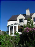
Homestay at Evans Bay New Zealand
Rachid Imerhane

Guide & Organizer of Treks - Mountain - Coast - Desert & Imperial Cities http://www.atlas-morocco.com
Clashview Kinlochbervie

Clashview Kinlochbervie
Inchardview
Inchardview
TREKKING ENCOUNTERS
FOR SUSTAINABLE ECO-TOURISM
Bayhead Self Catering, Isle of Harris

Delightful

http://www.documentdirect.co.uk
http://www.pacerpole.com

http://www.stridingahead.co.uk